Dryer and hotter weather worldwide, but specifically in Canada, has caused a crazy wildfire season, and they’re only one month into it. The fires have caused extensive damage, evacuations, and smoke… so much smoke. That smoke has covered the northern parts of the United States and has even been seen by satellites in space.
Cross-country smoke from wildfires isn’t new, this actually happens to the Northeast every year, but the smoke is usually much higher in the atmosphere. However, for almost the entirety of last week, the Northeast was covered in low-altitude smoke that put the parts of the Midwest to the eastern coastline into air quality alerts.
Cities like New York City were plunged into something out of a dystopian science fiction novel with smog and a red hue from the Sun. This unique scenario created an opportunity for some amazing YouTube videos and photos to come out.
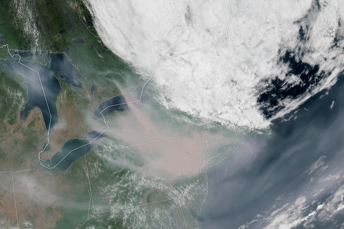
View of the smoke from space
Like clouds and dust, smoke can be seen on the numerous satellites that snap photos of Earth daily. NASA, the NOAA, and private companies have several satellites that routinely take pictures of Earth’s surface to follow along with the current weather and track climate change.
The Geostationary Operational Environmental Satellite 16 (GOES-16), developed by NASA and now operated by the NOAA, is one of many of those satellites. The GOES series of satellites capture a “full disk” of Earth’s surface daily and can have some pretty awesome resolution for close-up shots. This specific spacecraft was launched on top of an Atlas V rocket in 2016.
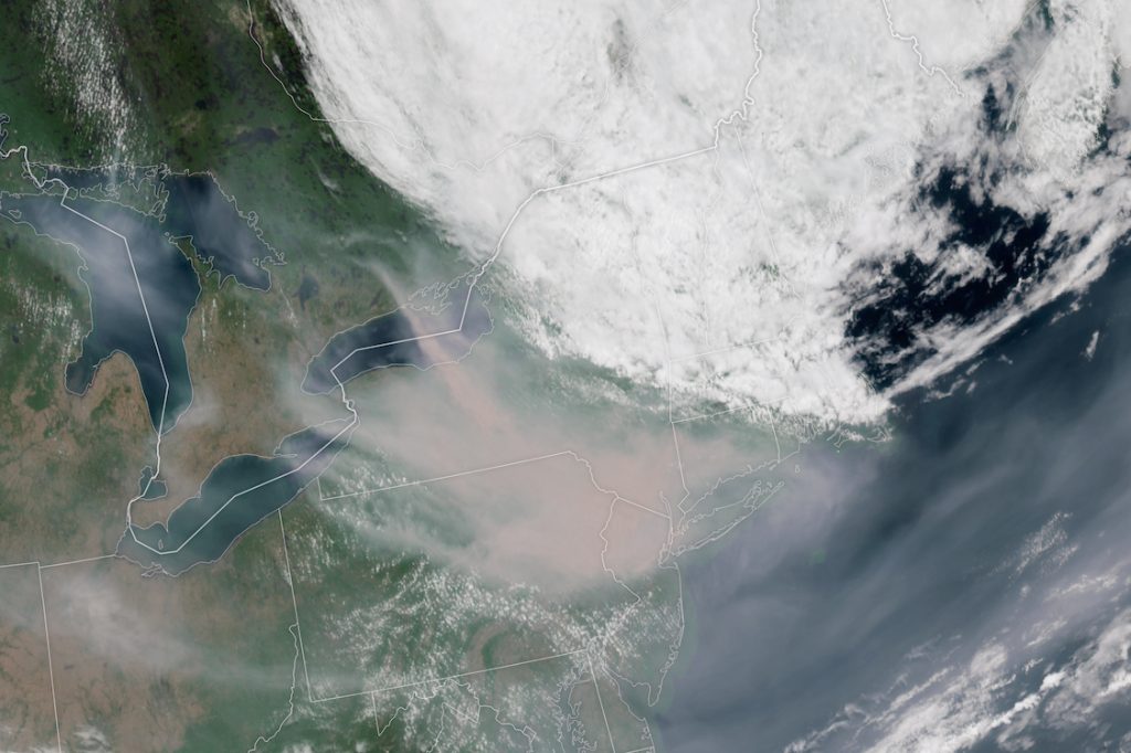
The normal dust we see yearly usually comes from fires in Western Canada; however, these fires close to Quebec are why the smoke was so much lower. Air quality monitors registered a record of over 400 micrograms per cubic meter in Syracuse, New York.
How satellites monitor our climate
The situation only looks to worsen as warmer seasons, thanks to climate change, have made large swaths of forest excellent timber for future fires. Severe weather has also worsened, with each year seemingly being “the worst hurricane season yet” for those living in the Gulf or East Coasts.
NASA and the private industry have stepped up their game, launching more and more satellites to monitor Earth’s warming climate. A recent addition is NASA’s Time-Resolved Observations of Precipitation structure and storm Intensity with a Constellation of Smallsats or TROPICS. (I thought I was done typing that name out after they finished launching, but I guess not.) These four satellites operate as a constellation, hence the name, to monitor changing storm activity along the equator.
The increased frequency of data on developing tropical storms will hopefully significantly improve the accuracy of projections used by local officials for evacuations.
Companies like Planet, BlackSky, and Capella have launched dozens of satellites each to produce a large amount of data on our planet. These images can be used to track deforestation, discover ecosystem changes, and improve farming. All necessary to start a fight to reverse climate change.
However, this is just a very small part that will make a fight even possible.
FTC: We use income earning auto affiliate links. More.


Comments